Public Safety
Rapid visualization with context for situational awareness, decision support and a historical record.
Derive meaning and make quick decisions
View visual and thermal video, 360 degree video and stills, and sensor data connected to Esri ArcGIS or Google Maps, with time-based context and search
Survae is a secure sharing platform for rapid visualization of multi-source, full motion georeferenced video, image and sensor data streams at the local, edge and cloud connectivity levels. Distribute data securely to select stakeholders, and navigate visual feeds quickly in the heat of the moment.
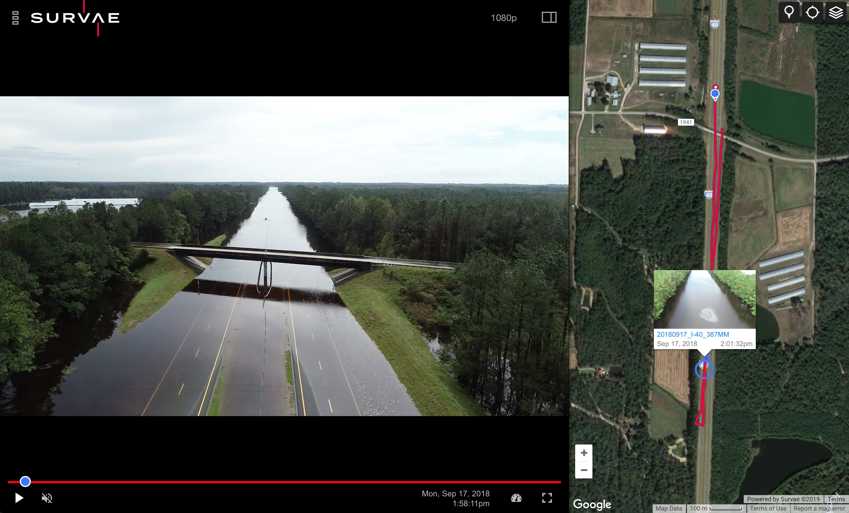
- All video, imagery and data is automatically connected to the map and a timeline. Every frame of video and imagery and all data is geolocated, date and time-stamped.
- Hover preview over the map and mouse back or forward along the route of the camera.
- Play the video from any point on the map. Easily share mapped video and data internally, across divisions, and with outside organizations, agencies and the public, as needed.
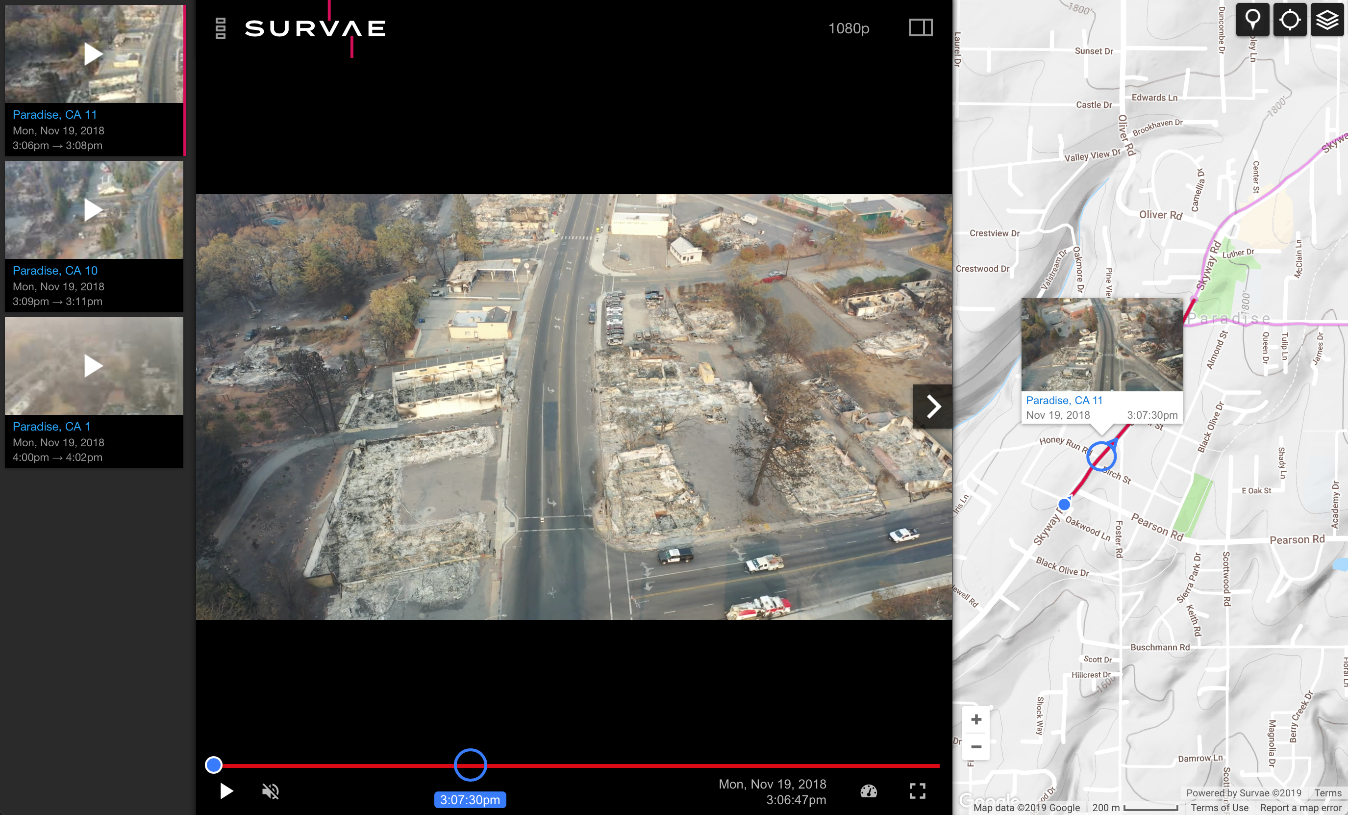
Camp Fire
Survae was used during the Camp Fire in Paradise, CA to provide rapid visualization of infrastructure and property damage and to quickly disseminate that information to provide situational awareness for government officials and to inform the public. The map above was created in a matter of just a few hours by flying the main streets of the town with small UAVs and then uploading the video to Survae.
Key Features
Survae provides all-source sensor fusion — the combination of archived video, imagery and sensor data in one platform — to replace manual overlays and solve time synchronization issues when responding to events or viewing historical data.
- Visualize video, multispectral, stills and sensor data with your own maps
- Near real-time and historical reconstruction of multiple vantage points of any location on one interface
- Share data on a map to multiple ops centers and even to vehicles via a laptop
Survae is available in the cloud, or as a local installation on private servers and laptops, enabling clients to manage video, imagery and data in whatever configuration they prefer. Offline capability available for remote operations in communications-denied environments.
“We have been using Survae for the past nine months. It is an invaluable resource and the security partners we share the data with have been very impressed. In particular, it helped us tie together numerous departments and get contextual situational awareness during the recent hurricane relief effort.”
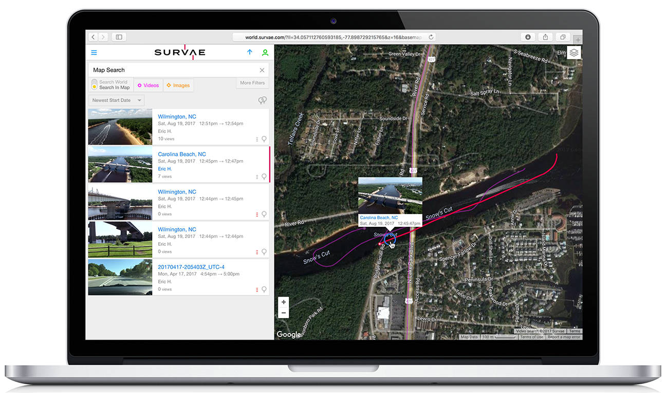
Manage, Search and Share Data with Ease
Survae provides a complete digital asset management platform. Use powerful geospatial, temporal and relational search to find events, places, and objects from multiple viewpoints. Easily share data within and across organizations or publicly.
Visual Search
See all of your video, image and data assets on a central map and use the map to search or browse; play videos or view photos directly from the search map.
Text, Map & Timeline Search
- Use relational, spatial and temporal methods to drill down to find content
- Run searches and queries of data using locations, date, time and tags: i.e. run a query on a “vehicle of interest” (how often has this vehicle been at this location over time?)
- Search using sensor and third-party data sets
- Create and store a “chain of evidence” with date and time stamps
- Use Esri maps and layers to drive search queries.
Sharing
Easily share links, embed videos or create playlists to share. Dynamically build shareable maps as content is uploaded to Survae. Automatically share video as an Esri feature service.
Survae is transforming public safety and post-disaster response
Rapid Visualization
Unprecedented situational awareness with near real-time context for events and post-storm or disaster damage assessments.
Perimeter Mapping
Easily export kmls of fire boundaries, cut lines, floodwaters, storm damage and more to master maps.
Search and Rescue
Search area clearing – know what you have searched or if you have searched the right area.
Visualization for the Public
Quickly disseminate video, imagery and data to the public with map context.
Reconstruct Events
Review historical events from multiple perspectives from a single interface for post-incident analysis and training.
Preplanning for Events
Aerial reconnaissance, situational awareness and 360⁰ preplanning for security and events.
Want to learn more or get started with our Free Tier?
Contact our team today.