Infrastructure
Rapid visualization with context for project planning and infrastructure inspections.
Derive Actionable Intelligence
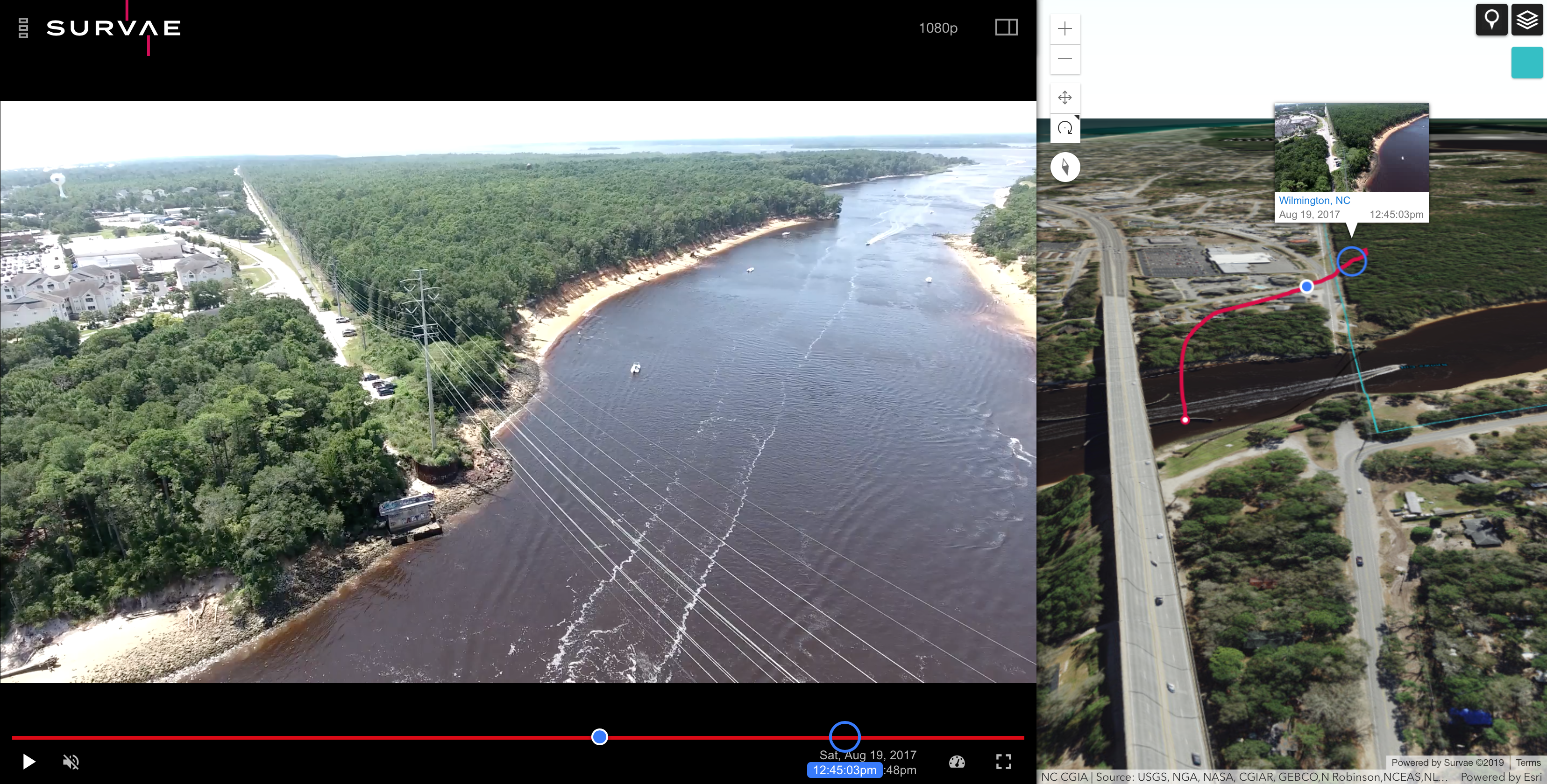
View visual and thermal video, 360 degree video and imagery, and standard imagery connected to maps and timelines.
Survae is tailor-made for infrastructure inspection workflows, providing a single secure platform to organize and visualize data streams for recorded video, imagery and data. Video of long linear inspections — roads, bridges, railways, pipelines and power lines — is viewable and easily understood with the context of your own maps, layers and a timeline.
- All video, imagery and data is automatically connected to the map and a timeline. Every frame of video and imagery and all data is geolocated, date and time-stamped
- Hover preview over the map and mouse back or forward along the route of the camera. Play the video from any point on the map.
Key Features
Visualize multiple feeds from the air, ground or underwater, with the context of your own ArcGIS or Google maps.
- Use powerful geospatial, temporal and relational search, driven by your own maps, layers, and GIS data, to find assets, visual inspections and assessments
- Use artificial intelligence to identify problems, for change detection, object recognition, or observing change over time via seamless integration with our AI partners or your existing vendors.
- Easily share mapped video and data internally or with clients.
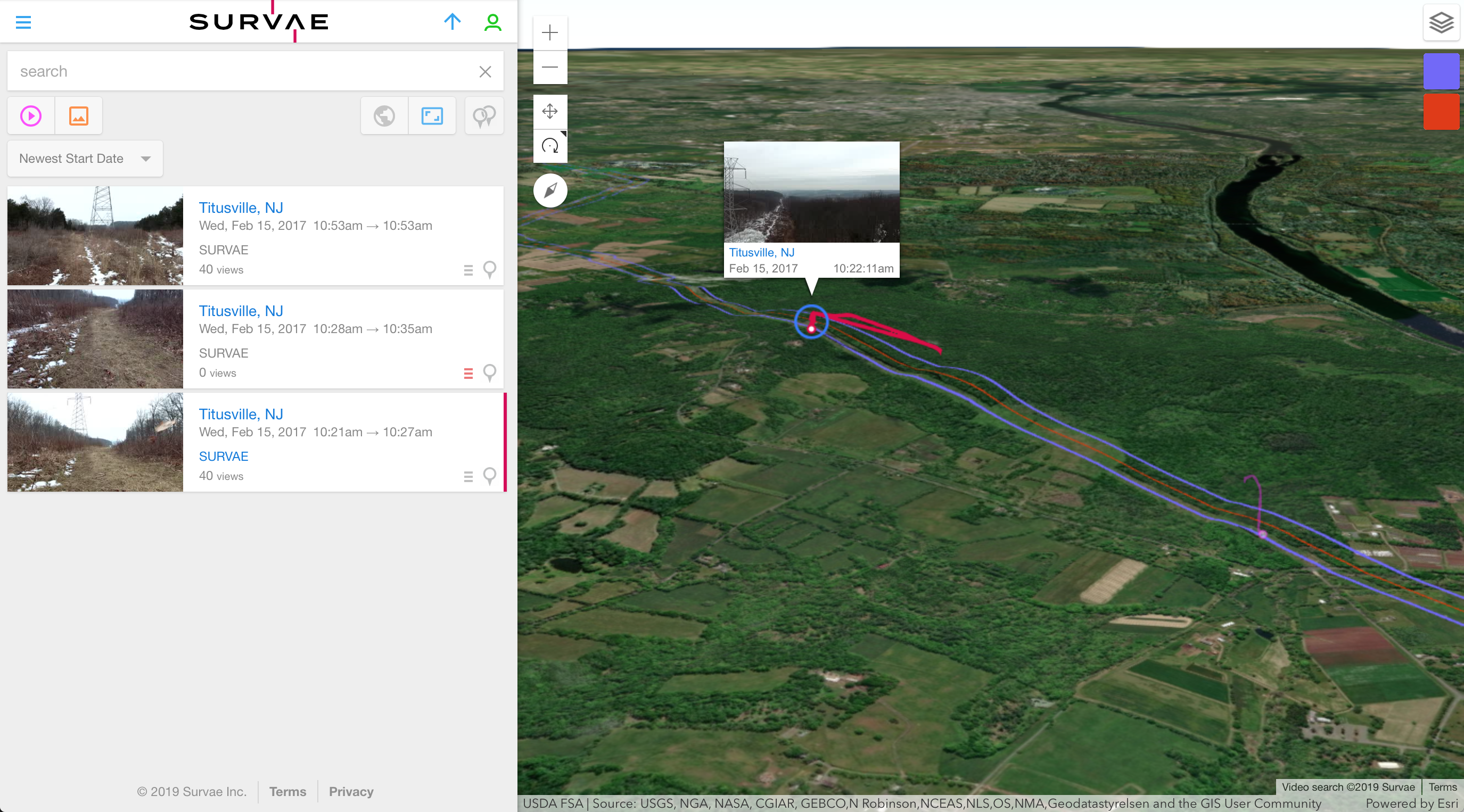
Manage, Search and Share Data with Ease
Survae provides a complete digital asset management platform. Use powerful geospatial, temporal and relational search to find events, places, and objects from multiple viewpoints. Easily share data within and across organizations or publicly.
Visual Search
See all of your video, image and data assets on a central map and use the map to search or browse; play videos or view photos directly from the search map.
Text, Map & Timeline Search
- Use relational, spatial and temporal methods to drill down to find content
- Run searches and queries of data using locations, date, time and tags
- Search using sensor and third-party data sets
- Use maps and layers to drive search queries.
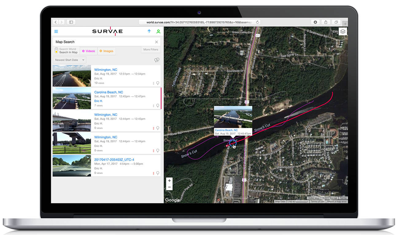
Easily share links, embed videos or create playlists to share. Dynamically build shareable maps as content is uploaded to Survae. Automatically share video as an Esri feature service.
How our infrastructure clients use Survae
Right of Way Inspections
Project Planning and Documentation
Quick Transects
Ground-based Inspections
Damage and Risk Assessment
Environmental Compliance
Want to learn more or get started with our Free Tier?
Contact our team today.