Government
Situational Awareness and Decision Support for All-Hazard Incidents and Field Operations
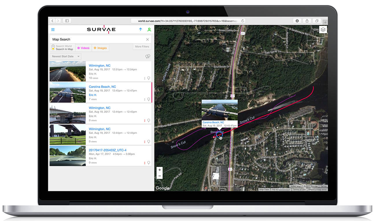
Survae is a secure sharing platform for rapid visualization of multi-source, full motion georeferenced video, image, and sensor data streams at the local, edge, and cloud connectivity levels.
Currently deployed with law enforcement, emergency responders, disaster relief organizations, and critical infrastructure entities, Survae’s unique spatial, relational, and temporal solution provides actionable and near-real time intel for team-wide situational awareness, enhanced coordination, decision support and a historic record for both incident response and regular agency operations.
Survae, Inc.
Phone: 888-507-1992, ext 1
Email: info@survae.com
Twitter: @survae
CAGE Code: 88SV9
DUNS Number: 079953004
NAICS Codes:
541370 Surveying & Mapping (ex. Geophysical) Services
518210 Data Processing, Hosting, & Related Services
519130 Internet Publishing, Broadcasting & Web Search
What makes Survae the new geospatial intelligence tool of choice?
- Collate context. Quickly organize, view, and share live and recorded video, still imagery, infrared, and other sensor data.
- Device-agnostic. Ingest content from manned aircraft, UAS, and ground-based mobile devices.
- Common Operating Picture. Use your GIS operations Google Map or Esri ArcGIS Online as the Survae basemap.
- One-click GIS overlays. Import KMLs and shapefiles directly to Survae for rapid sharing between GIS map production cycles.
- Permissions scalable. Configure viewing for users within a single incident, incident complexes, or geographic coordinating groups.
- Use in disconnected environments. Run Survae from a local laptop or a secure cloud connection today; sync between the two (coming soon).
Past Performance
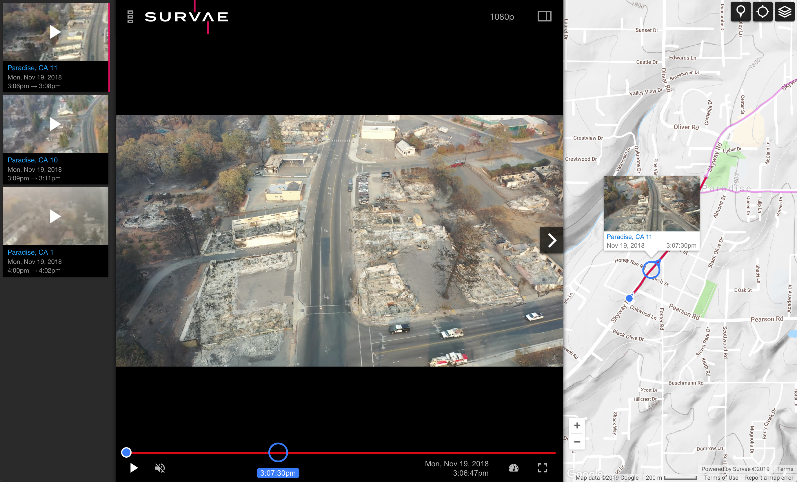
Camp Fire – California
Survae was used during the Camp Fire in Paradise, CA to rapidly provide visualization of infrastructure and property damage and to quickly disseminate that information to provide situational awareness for government officials and to keep the general public informed. Once uploaded to Survae, video recorded by public safety drone teams was immediately viewable connected to Butte County’s ArcGIS maps with their own data layers. Survae’s flexibility to add layers such as property lines on top of the map proved invaluable in enabling residents to easily understand how their property and their neighborhoods had fared.
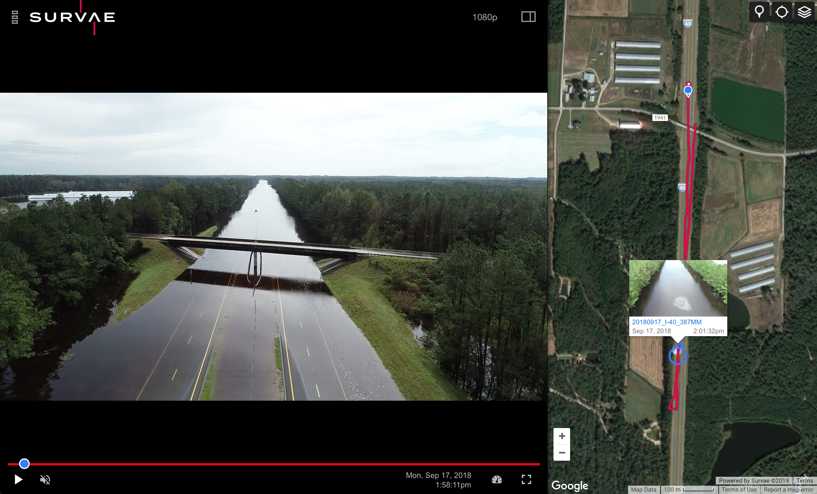
Hurricane Florence – North Carolina
The North Carolina Highway Patrol used Survae in the wake of Hurricane Florence to efficiently document flooding of roads and highways around the state. In addition to providing immediate mapped situational awareness, Survae also demonstrated its capabilities for enabling sharing and collaboration between agencies. By creating an Esri ArcGIS feature service, Survae enabled all videos uploaded by the highway patrol to automatically became available as a layer within the state DOT’s GIS system, further enhancing the information available for emergency response.
Key takeaways from using Survae with the Camp Fire and Hurricane Florence:
- Georeferenced video is an effective tool for rapidly visualizing a heavily impacted area following a major disaster.
- The collection of video is exponentially faster than traditional mapping workflows and the interpretation of the end products are intuitive for a broad audience. The positioning capabilities of georeferenced video within the first few hours of an emergency is ideal for providing situational awareness, damage assessment, and precise targeting of more labor-intensive drone mapping efforts in the following hours and days.