News and Media Resources
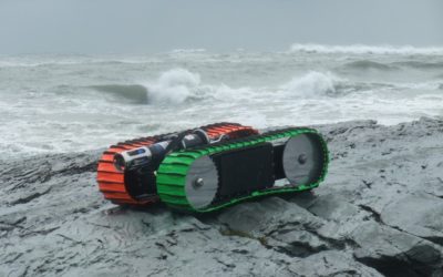
Survae and C-2i Partner to Bring Geolocated Video and Sensor Data to Amphibious Robotics
Sea Otter, the world’s first tether-less amphibious robotic crawler, is now integrated with Survae, providing a complete solution for capturing and displaying video and sensor data connected to maps.
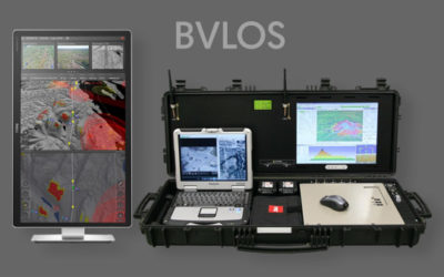
Kongsberg Geospatial and Survae Partner to Provide Integrated Video Management Capability within IRIS GCS
The IRIS ground control station will provide a seamless workflow allowing drone operators to manage, view, store and retrieve multiple video streams from multiple simultaneous drones.
About Survae
Survae provides a data visualization software platform for managing and viewing live and recorded video, still imagery, and multiple sensor streams with map and time-based context and search capability. Survae uniquely enables organizations to leverage massive datasets to visualize and share a unified view of events and places, so that stakeholders can understand situations and make decisions more readily. No other company addresses the problem of integration and context for disparate platform, sensor and data sets.
Media Inquiries
Survae, Inc.
info@survae.com