Integrations
In addition to supporting industry-standard devices such as DJI drones, Survae also builds custom APIs and specialized integrations for device manufacturers looking to visualize imagery and data using our interactive maps, timelines and search engine to provide an end-to-end solution for their customers. Examples of recent integrations include:
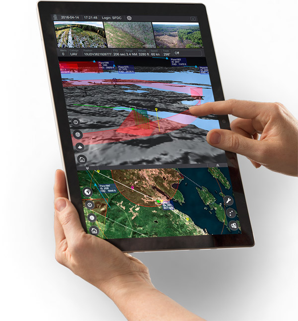
Kongsberg Geospatial
IRIS Ground Control Station
Kongsberg Geospatial’s IRIS UAS Ground Control Station (GCS) enables a single operator to seamlessly manage multiple BVLOS drone flights simultaneously. With the integration of Survae’s capabilities with IRIS, multiple video streams can be archived, stored and made available for immediate retrieval in real-time. Viewers watching the video that has been captured can move back and forth between live and archived streams and preview anywhere along the route taken by any of the drones — every frame of video is geolocated and date and time stamped for near real-time analysis or for post-mission archival search.
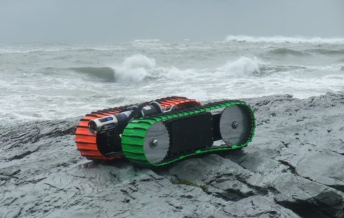
C-2i Innovations
Sea Otter
C-2i Innovations’ Sea Otter, the world’s first tether-less amphibious robotic crawler for inspection, sampling and mapping of shore and water regions, from oceans and harbors to rivers, estuaries, marshes, and tailing ponds.
We connect the video and sensor data collected by the device to our platform for easy visualization of what the device is seeing and collecting — using maps and timelines to identify where the device is located at all times.